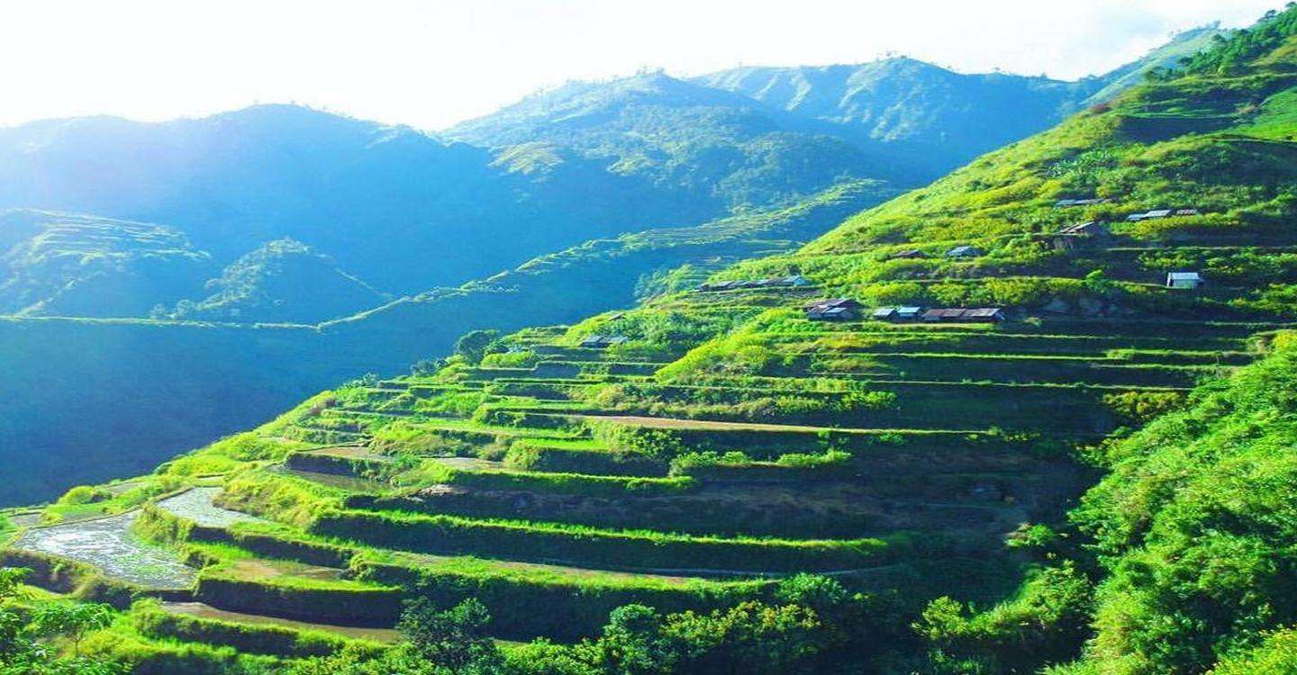
Kalinga, officially the Province of Kalinga, is a landlocked province in the Philippines situated within the Cordillera Administrative Region in Luzon. Its capital is Tabuk and borders Mountain Province to the south, Abra to the west, Isabela to the east, Cagayan to the northeast, and Apayao to the north. Kalinga and Apayao are the result of the 1995 partitioning of the former province of Kalinga-Apayao which was seen to better service the respective needs of the various indigenous peoples in the area.
Unbeknownst to many, President Emilio Aguinaldo proclaimed Lubuagan town the seat of government for 73 days from March 6, 1900, to May 18, 1900, before finally fleeing to Palanan.
The province's name is derived from the Ibanag and Gaddang noun "kalinga", which means "enemy", "fighter", or "headtaker".
Kalinga was taken from Cagayan and Isabela provinces and established by the US Government through Philippine Commission Act No. 1642 on May 9, 1907, as a sub-province of Lepanto-Bontoc.
Kalinga was later organized as one of the sub-provinces of Mountain Province, created by Act No. 1876.
In the early years, the subprovince underwent series of territorial changes. Part of Kalinga was transferred to another sub-province Bontoc through Executive Order No. 53 in 1914. In the municipal district of Pinukpuk, barrios were moved to Balbalan in 1926; as well as parts of it to Conner in Apayao in 1927.
Kalinga became part of a province along with Apayao when the old Mountain Province was divided into four separate provinces through Republic Act No. 4695 in 1966 and, with Abra, became part of the territories in the Cordillera Administrative Region which was created through Executive Order No. 220 in 1987. Kalinga was converted into a province in 1995 by virtue of RA No. 7878 when majority of the voters in Kalinga-Apayao approved in a plebiscite the division of the province into two.